This page is under construction and will be updated throughout the school year...
Geography at Pittington
Nursery – Exploring Near and Far
In Nursery, we looked at examples of different types of maps including road maps, walking maps and atlases. We also talked about the different features in our outside area and identified the key landmarks such as the caravan, shed, mud kitchen and sand pit.
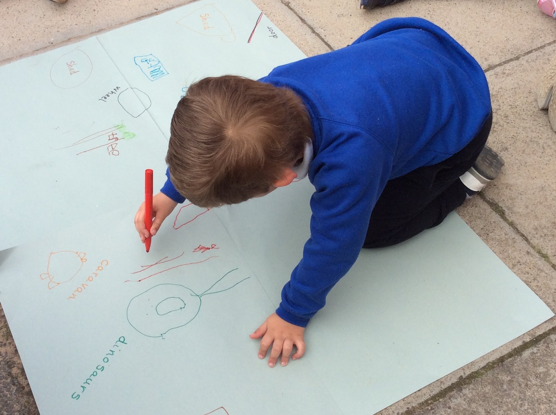
We used a large piece of paper and worked together to create a map of our garden. After that, we chose the correct coloured pen to draw on the landmarks and even labelled them. We then used our map to find different areas of the garden and had great fun too! We talked about how we had created a map with a ‘bird’s eye’ view.
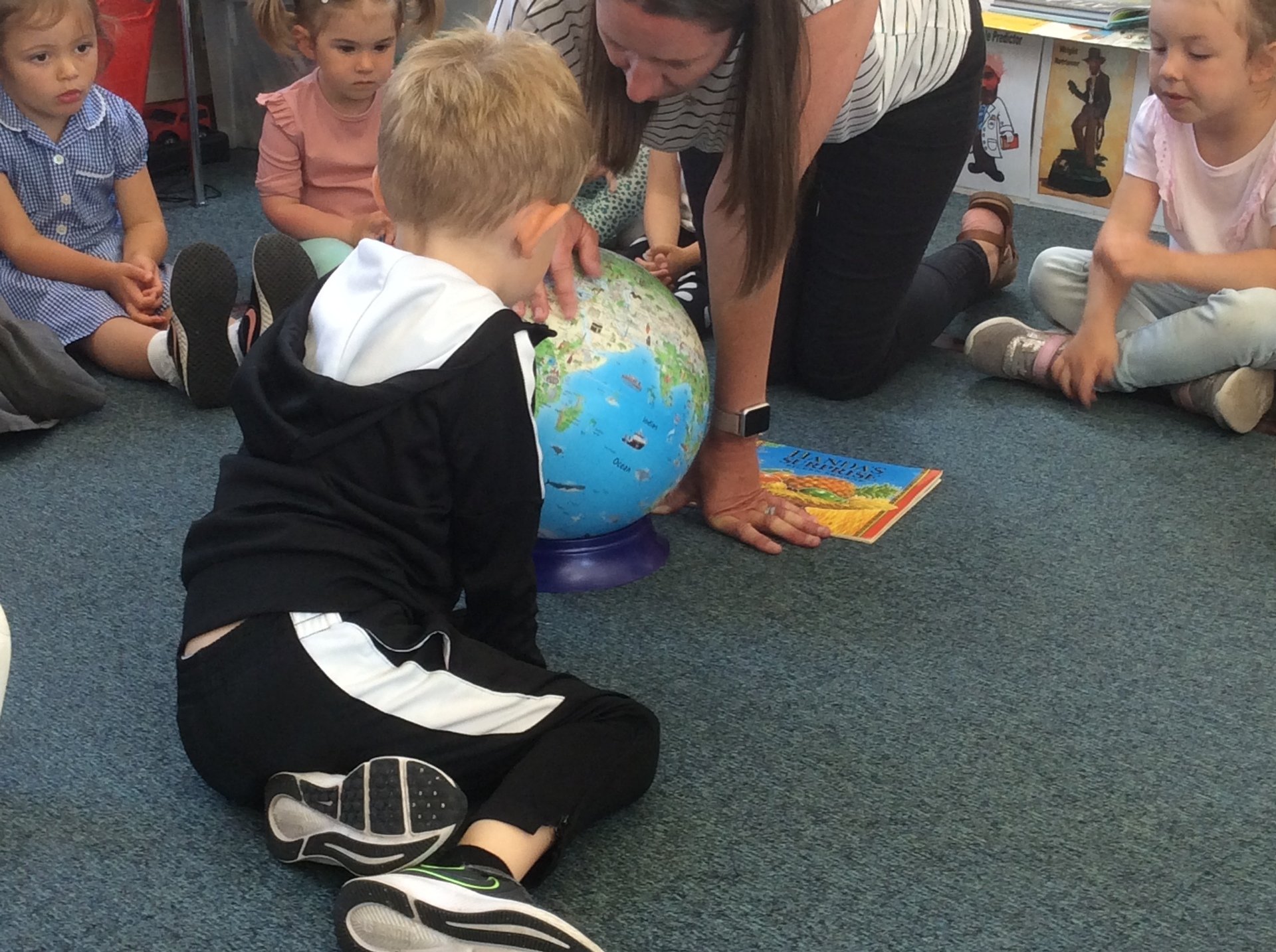
During our work around the book ‘Handa’s Surprise’ we talked about the story setting. This led us to talk about the continent of Africa. We used our globe to locate Africa and did some research finding out about the River Nile, the Sahara Desert and the different animals which lived in different parts. We learned that many different countries make up Africa with people speaking many different languages too.
Reception – Location, Location, Location
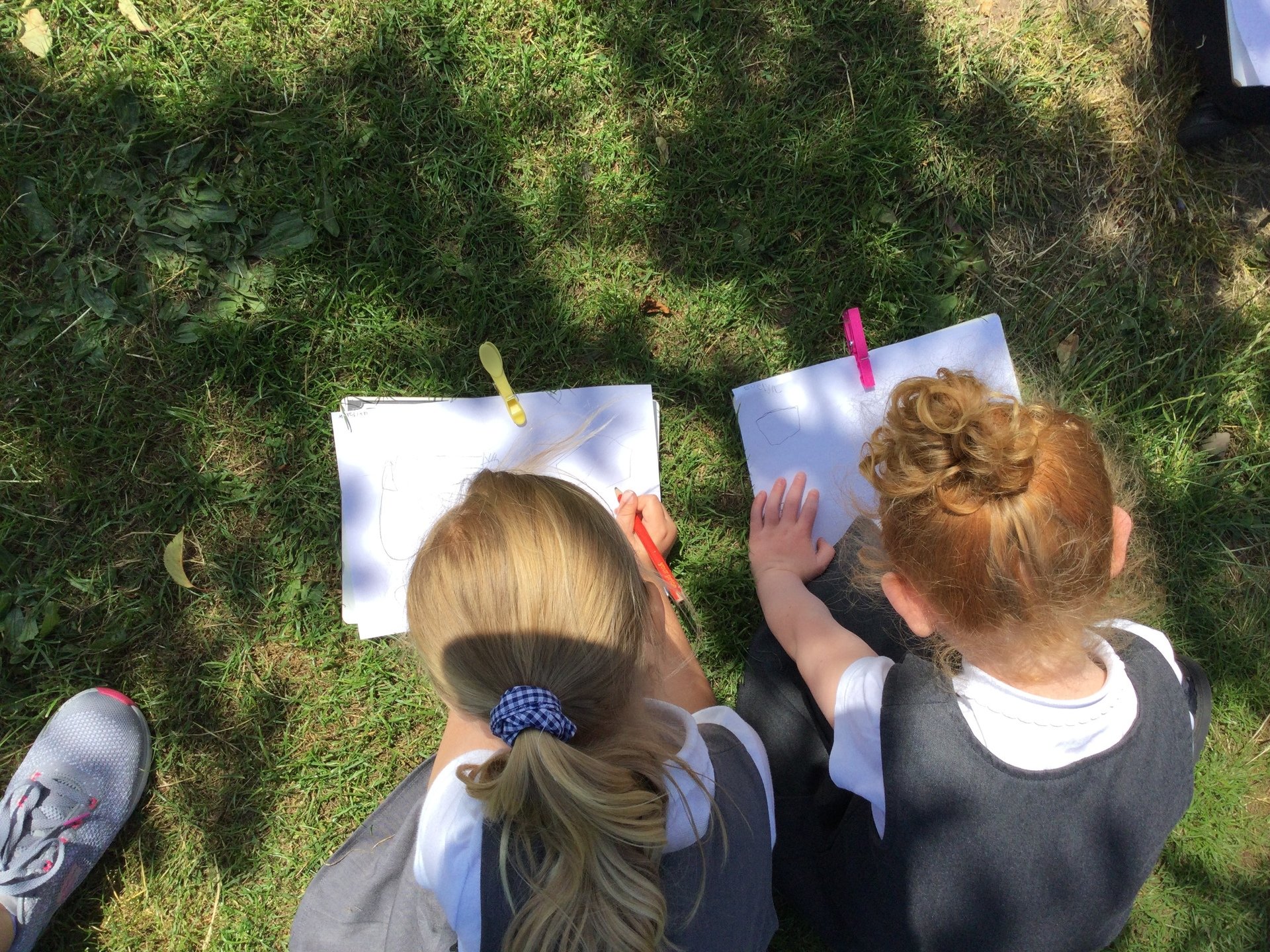
The children were challenged to work out where the best spot would be to home our Bug hotel. They needed to think about the spaces where children could be running, building, using water etc. as well as the areas that were too uneven and not flat.
 |
 |
Once they had discussed their suggestions we looked at how a map can help us to plan things as well as locate things. The children all created their own map of the outdoor area ensuring they included all of the static objects that could not be moved, such as the sandpit, mud kitchen, trees, and climbing frame. Finally, the children had to indicate on their map where they feel the Bug Hotel should go.
We had some great suggestions and reasons as the children had lots to consider before making their judgement!
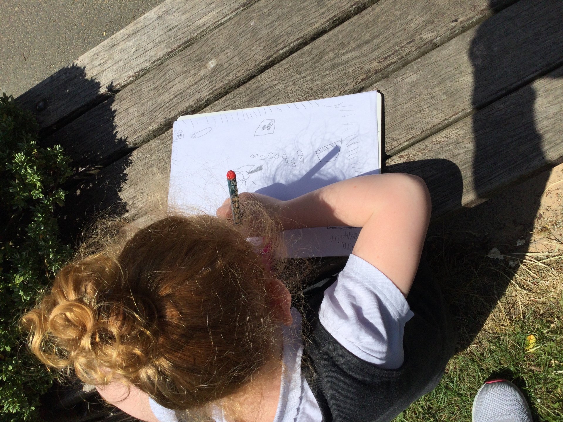
Year 1 – Our Key Stage One Cartographers
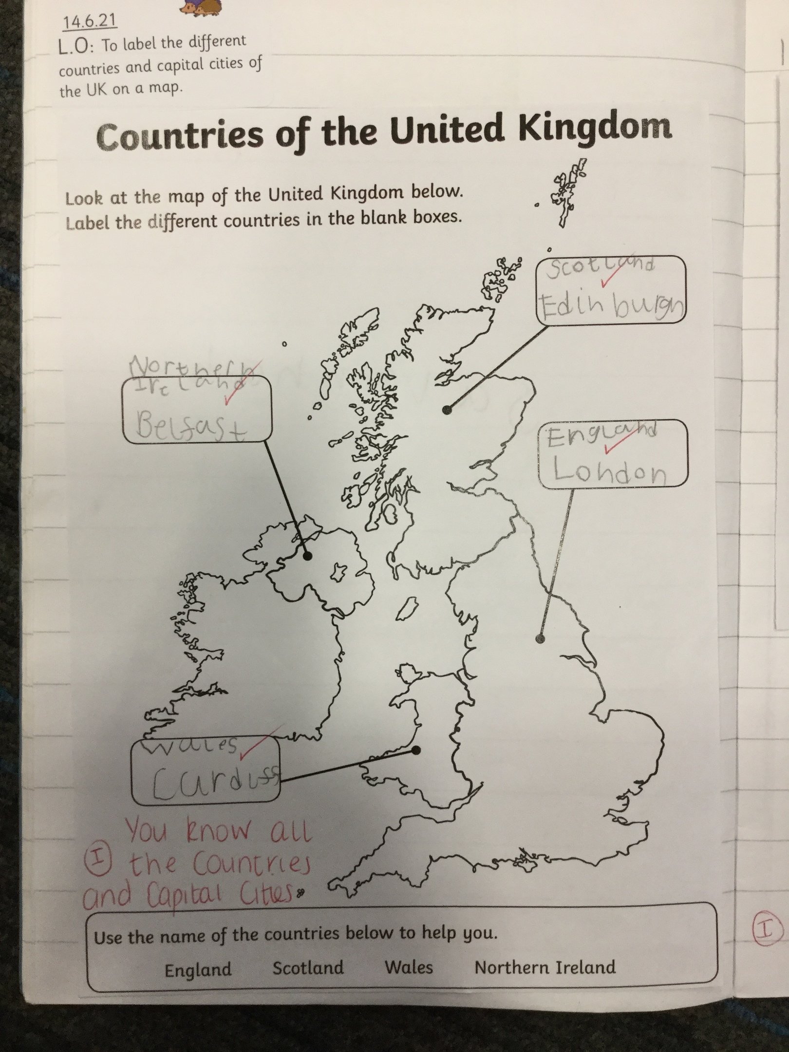
In Geography this term we have been learning about the different countries of the United Kingdom and what their capital cities are. We have also matched the flag to the country.
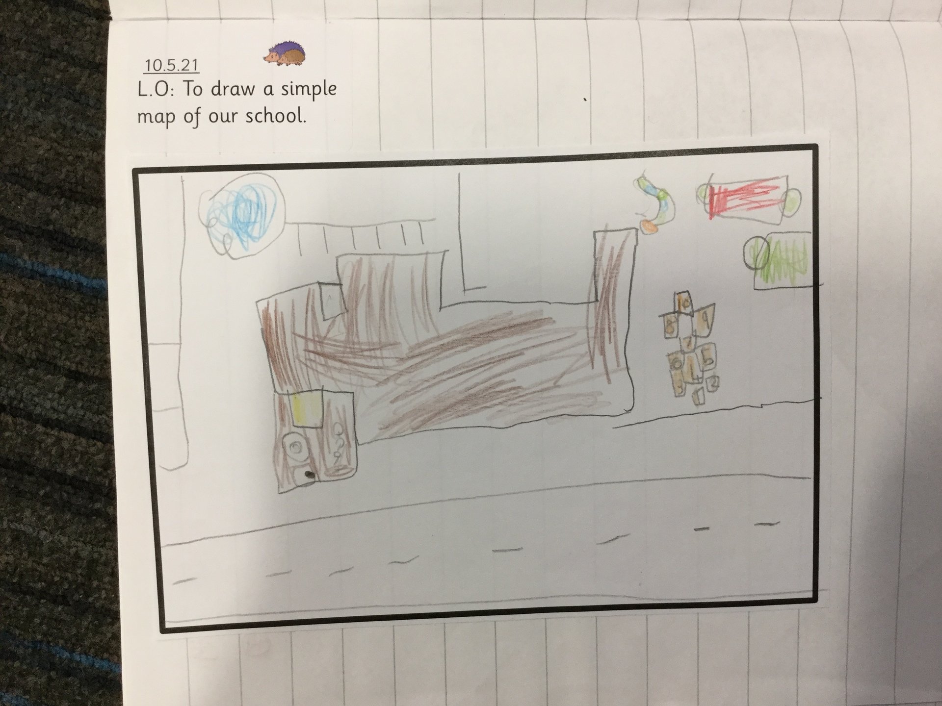
We have also been working on our mapping skills looking at what different map symbols mean and why they are used. Next we drew our own maps of the school grounds just in case Mr Shackler ever gets lost!
 |
 |
Year 2 – Local Heroes
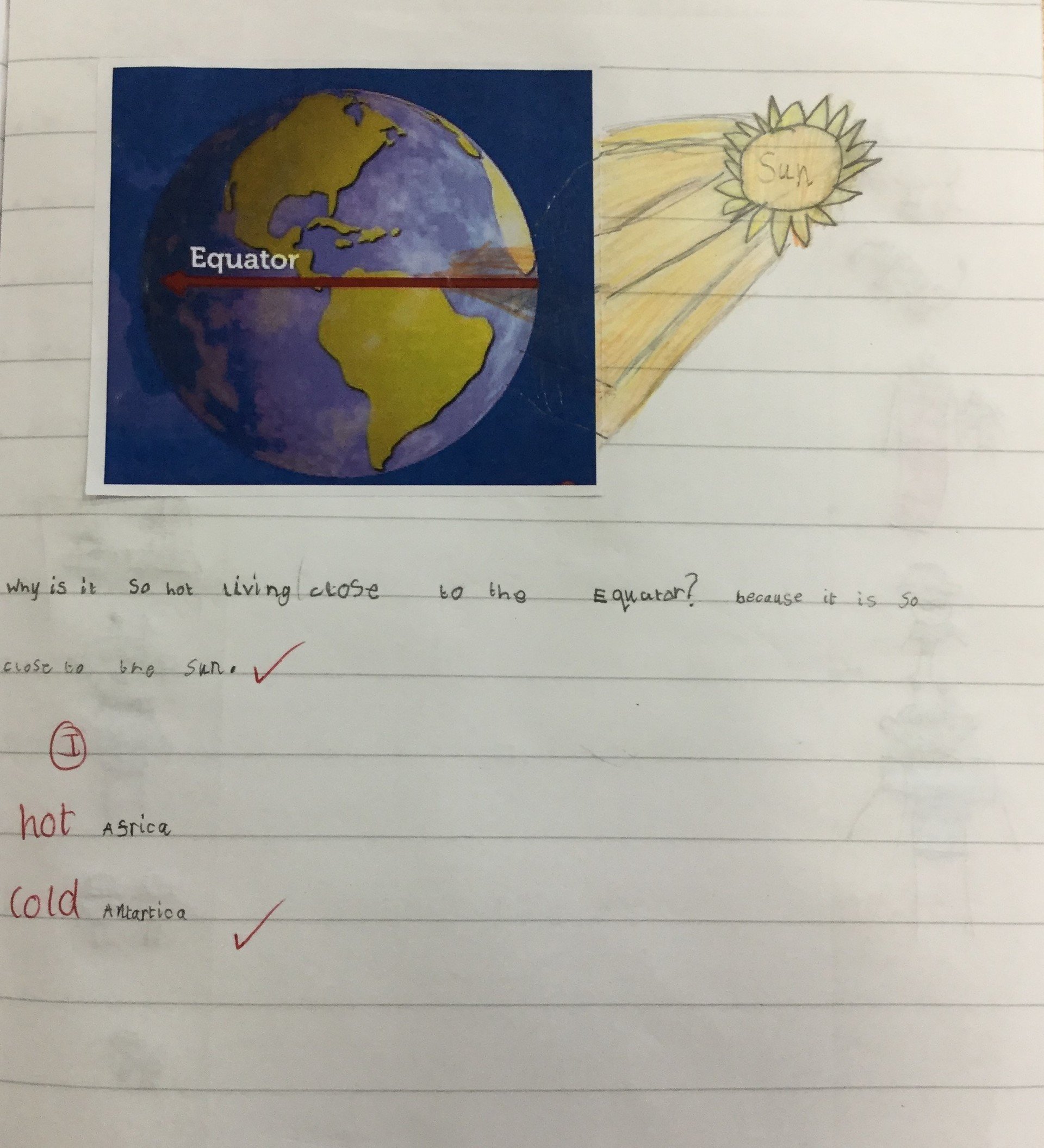
Year 2 have used world maps and atlases to find out about the Equator this term. We know that the hottest parts of the world are closest to the Equator and where the coldest parts are in relation to the North and South Poles.
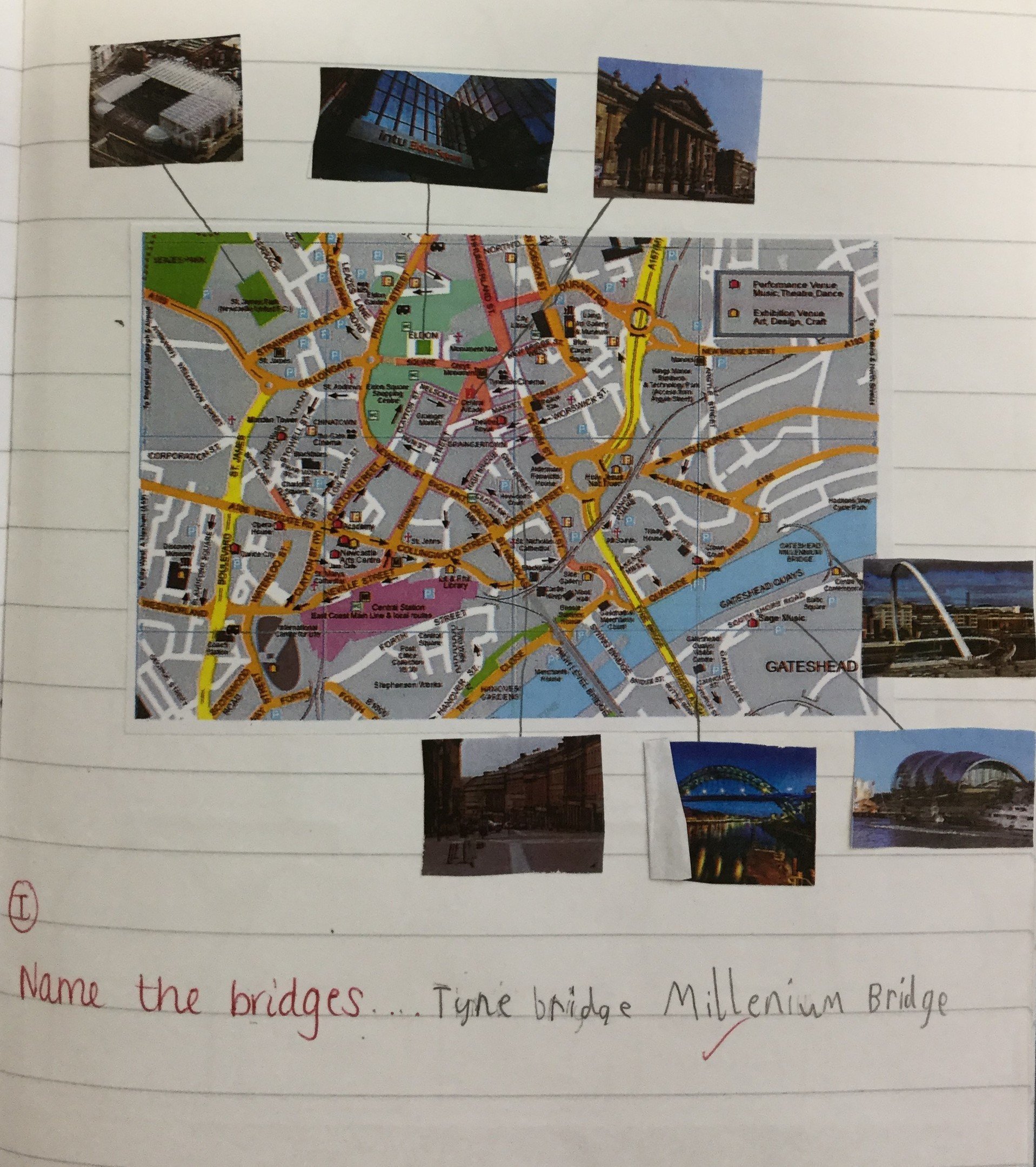
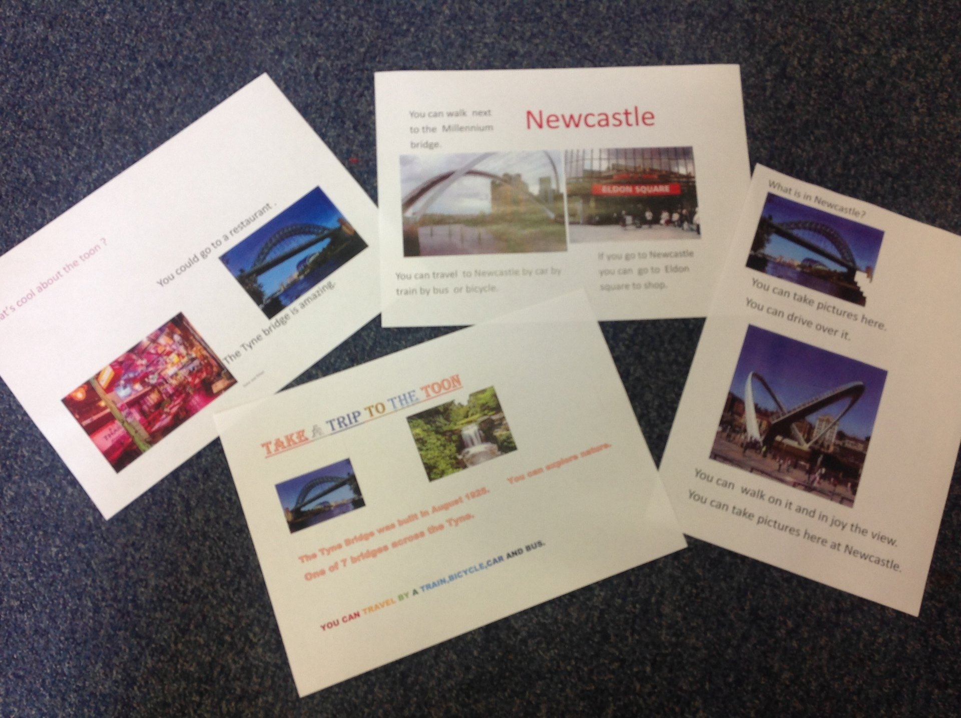
We have found out about our local area and we can identify the human and physical features of Newcastle upon Tyne. We used our knowledge to make postcards to advertise ‘what’s cool about the Toon?’ We used photographs of lots of landmarks. Which landmark would you like to visit?
 |
 |
Year 3 – Classifying Climates
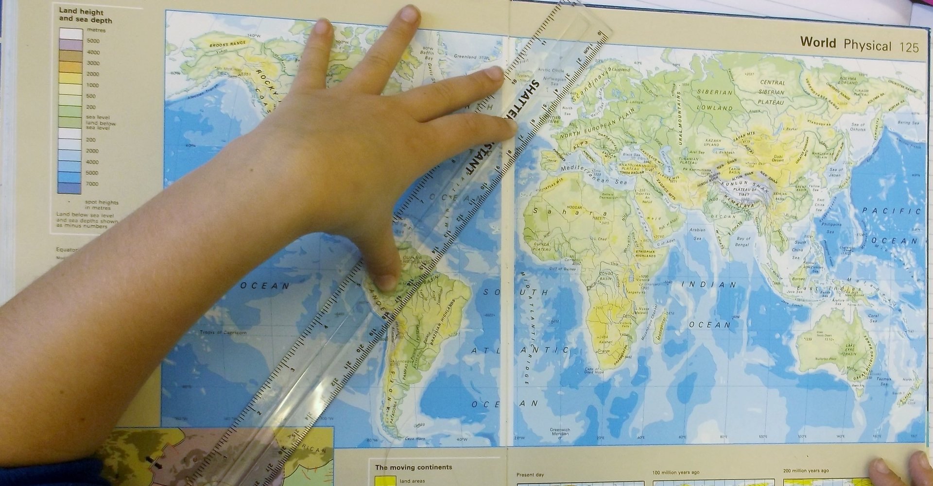
During this summer term we continued learning about the earth and its representation on a globe compared with Google Earth and DigiMap software. We revisited what we had learnt about Russia in the autumn term and described its position in the world relative to the Arctic & Antarctic circles, and the two hemispheres.
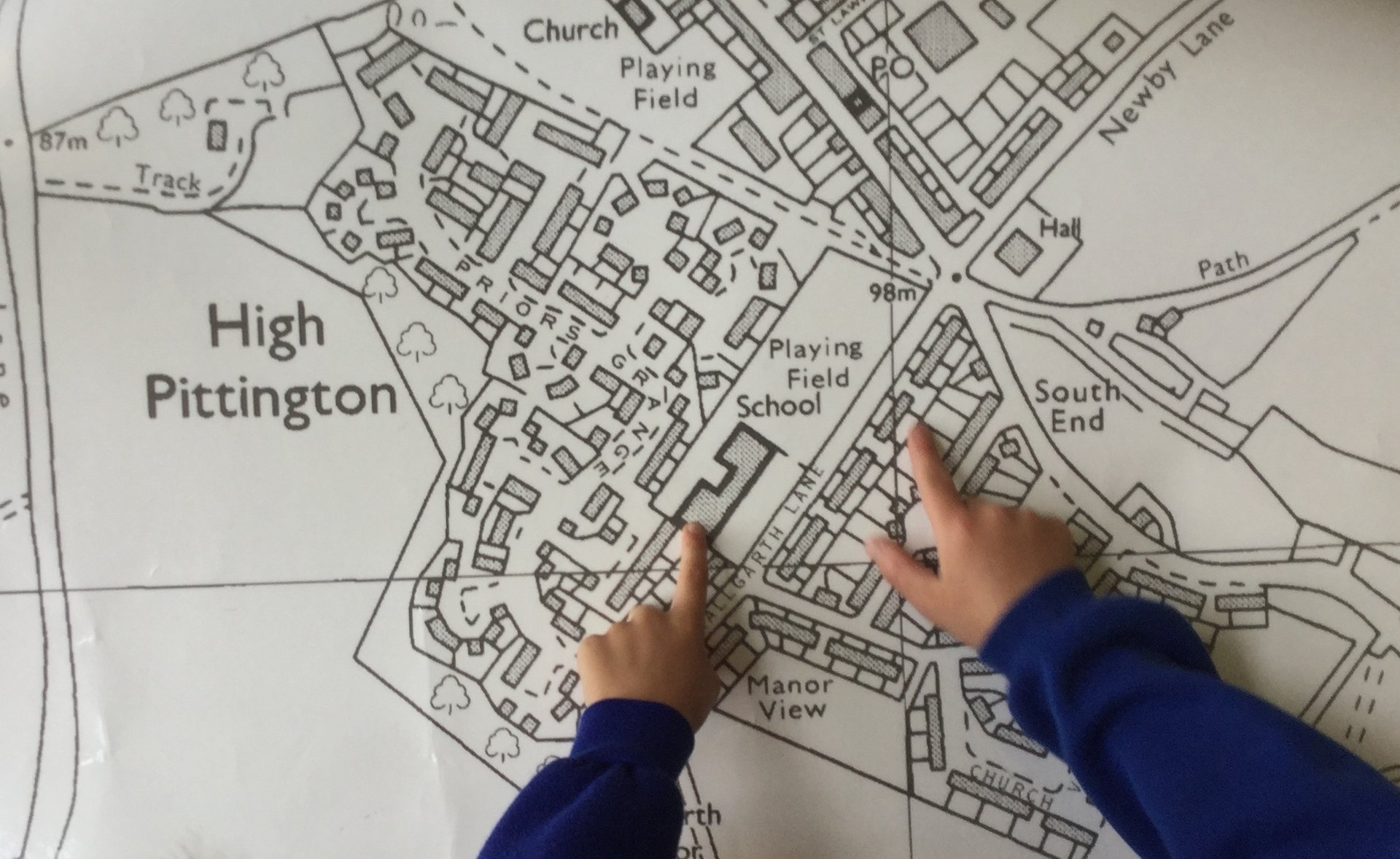
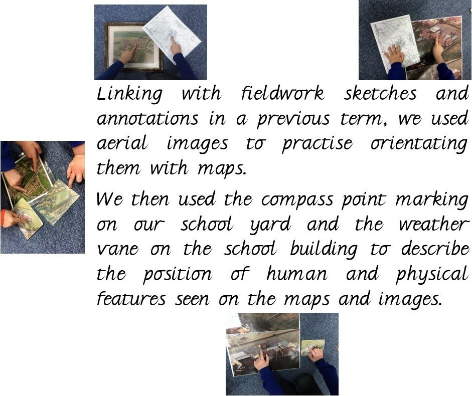
We revisited fieldwork from a previous half term and learnt more about the north east area of UK, using a selection of printed maps and aerial photographs to better understand the human and physical geography of our local area, both past and present.
 |
 |
We now know more geographical vocabulary and facts about climate zones, which are polar (including tundra and snow/ice), temperate, arid, equatorial (tropical) and Mediterranean. This was quite challenging because we used to believe that a desert was sandy and without life, but now know that life can exist in some deserts and that there are non-sandy deserts too. Some of us thought that all deserts were located near the equator, but learned about a desert on Antarctica.
Year 4 – Moving on to Higher Ground
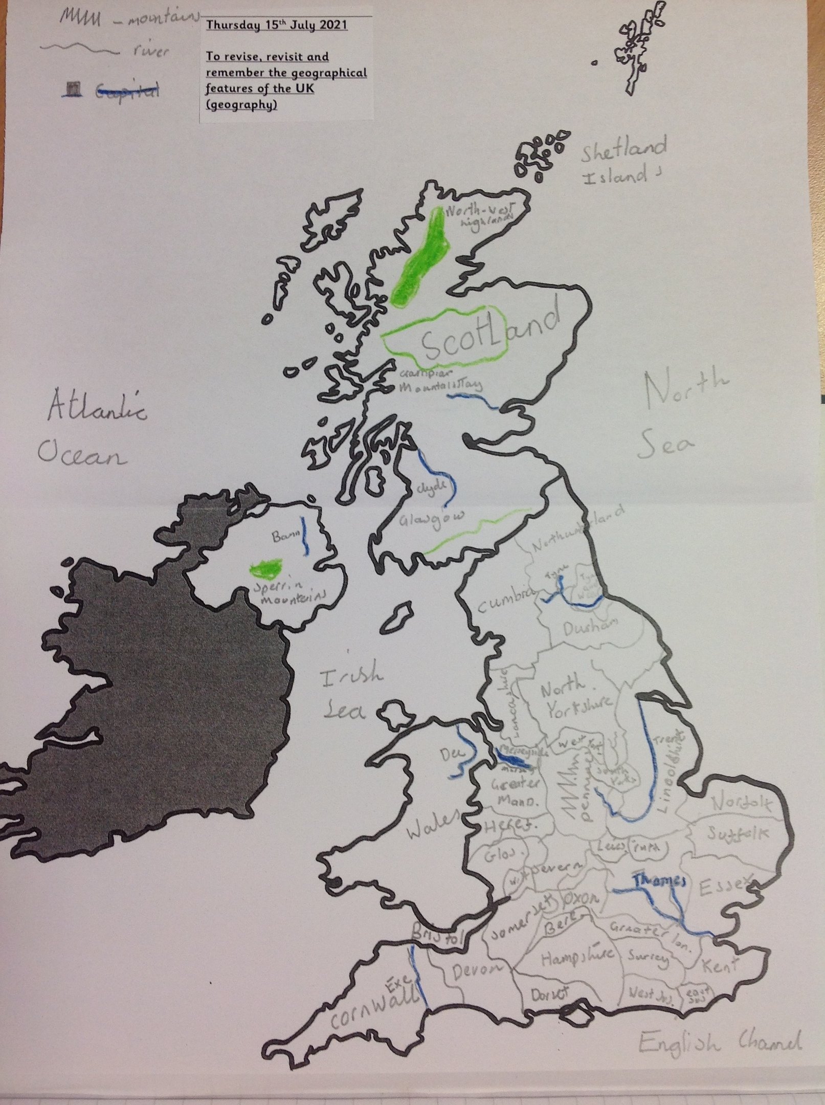
Year 4 have been working hard to develop their atlas using skills by locating areas of higher ground around the UK.
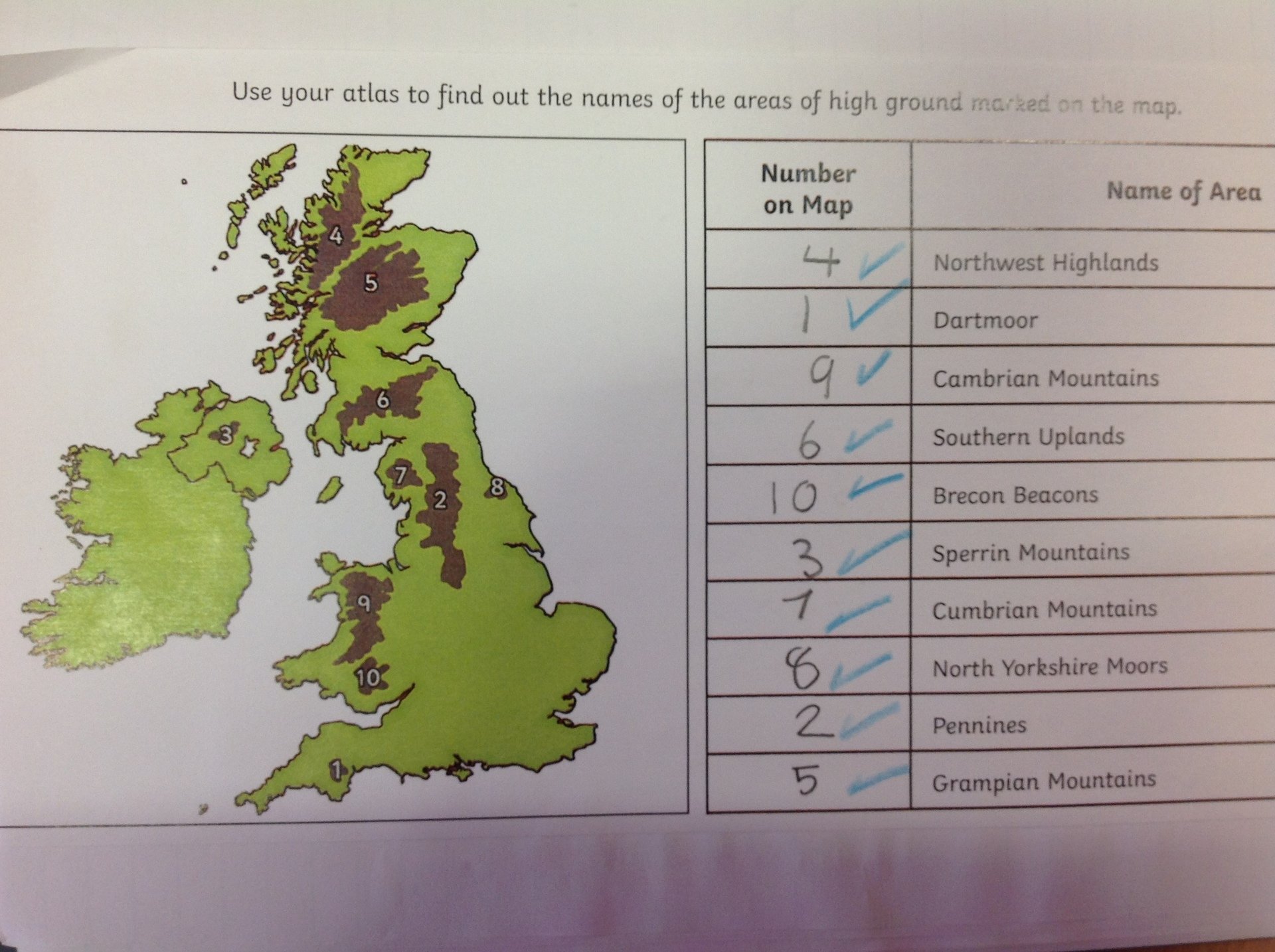
It has been a year packed full of learning in geography for year 4 and this showcases a snapshot of the knowledge the children have accrued over this year. Children used their prior learning to independently label and annotate the map of the UK and surrounding seas to collate everything they have learned.
Year 5 – Postcards from Around the World
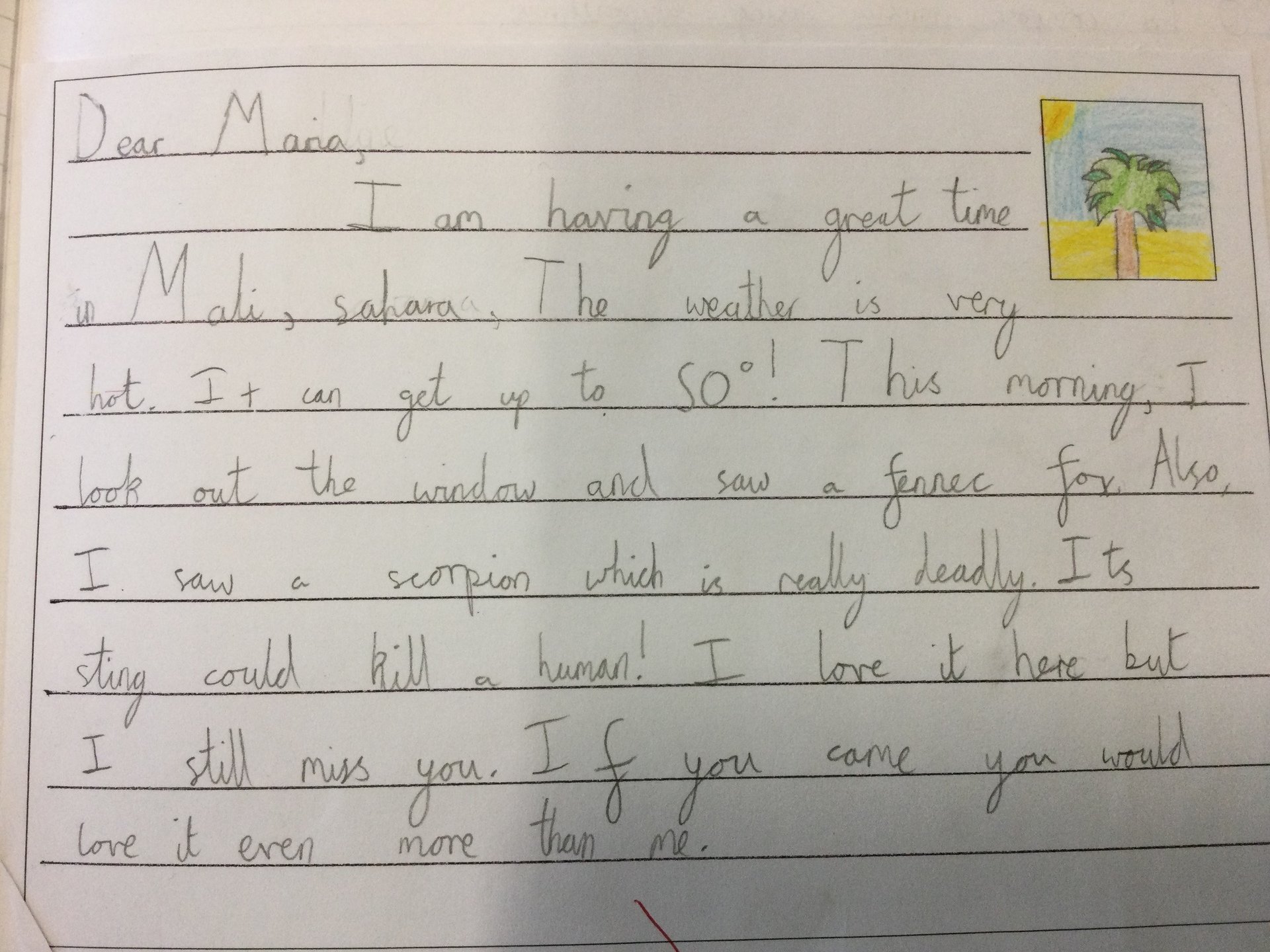
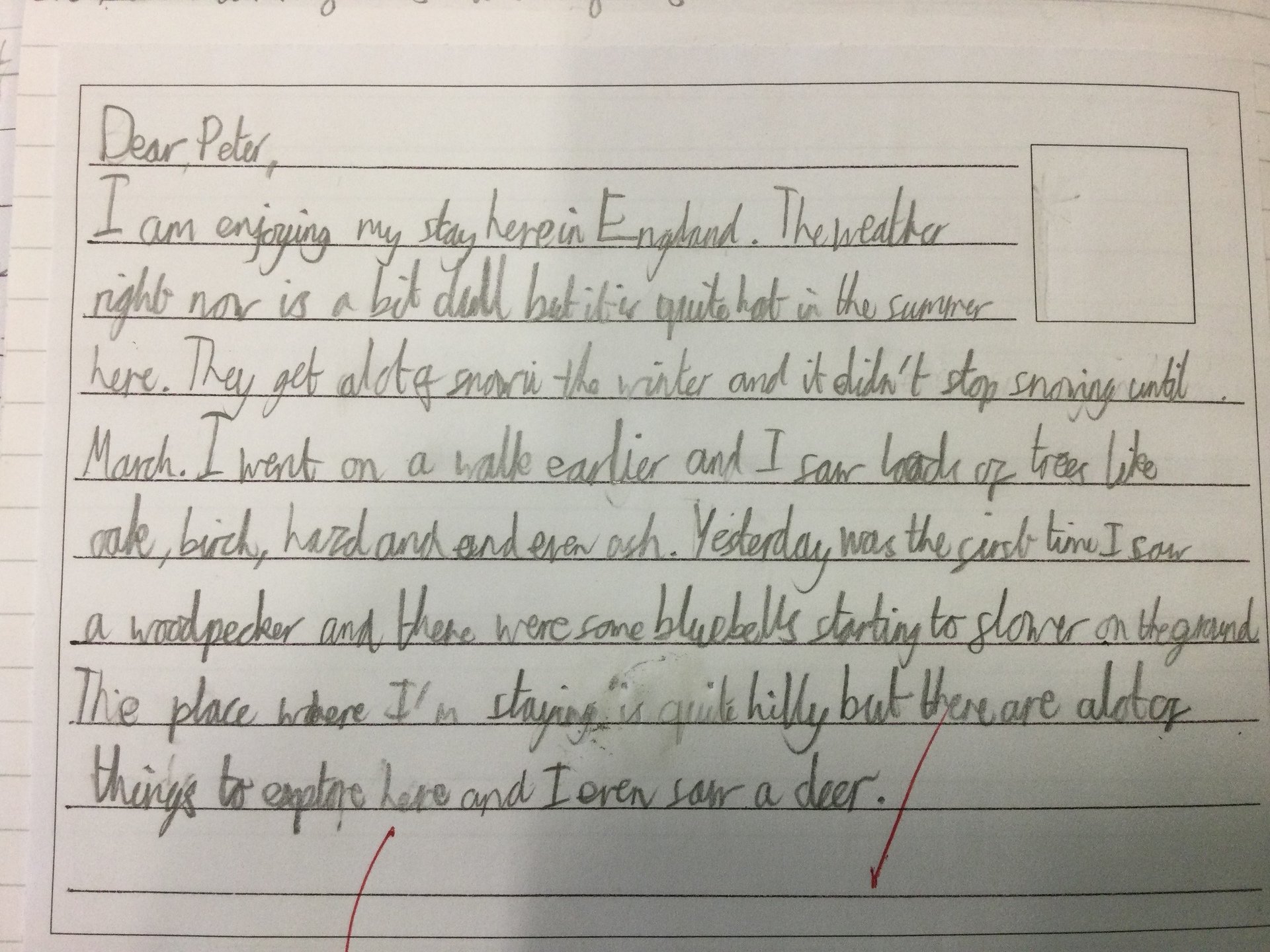
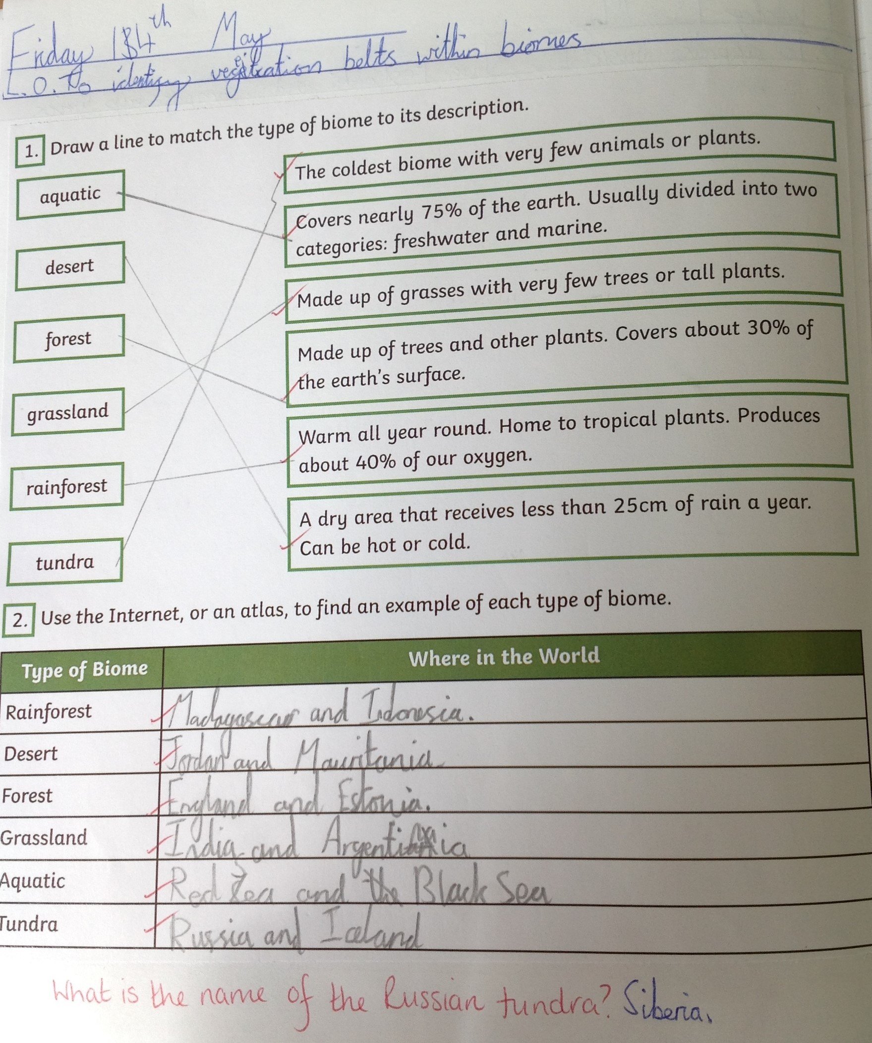
In Year 5, we have been developing our global knowledge and understanding. We have continued to develop our accuracy and recall with regard to the location of European and South American countries and the capital cities of each. The children really are getting quite quick with this. We have also explored the topic of biomes and the range of these found across the globe. We even write postcards from different places around the world and could identify the biome of features which we would find there.
 |
 |
To further our global understanding, we have also studied the Equator, Tropics of Cancer and Capricorn, and the Arctic and Antarctic circles. We have discussed how location within or near to these impacts upon climate and other geographical features.
Year 6
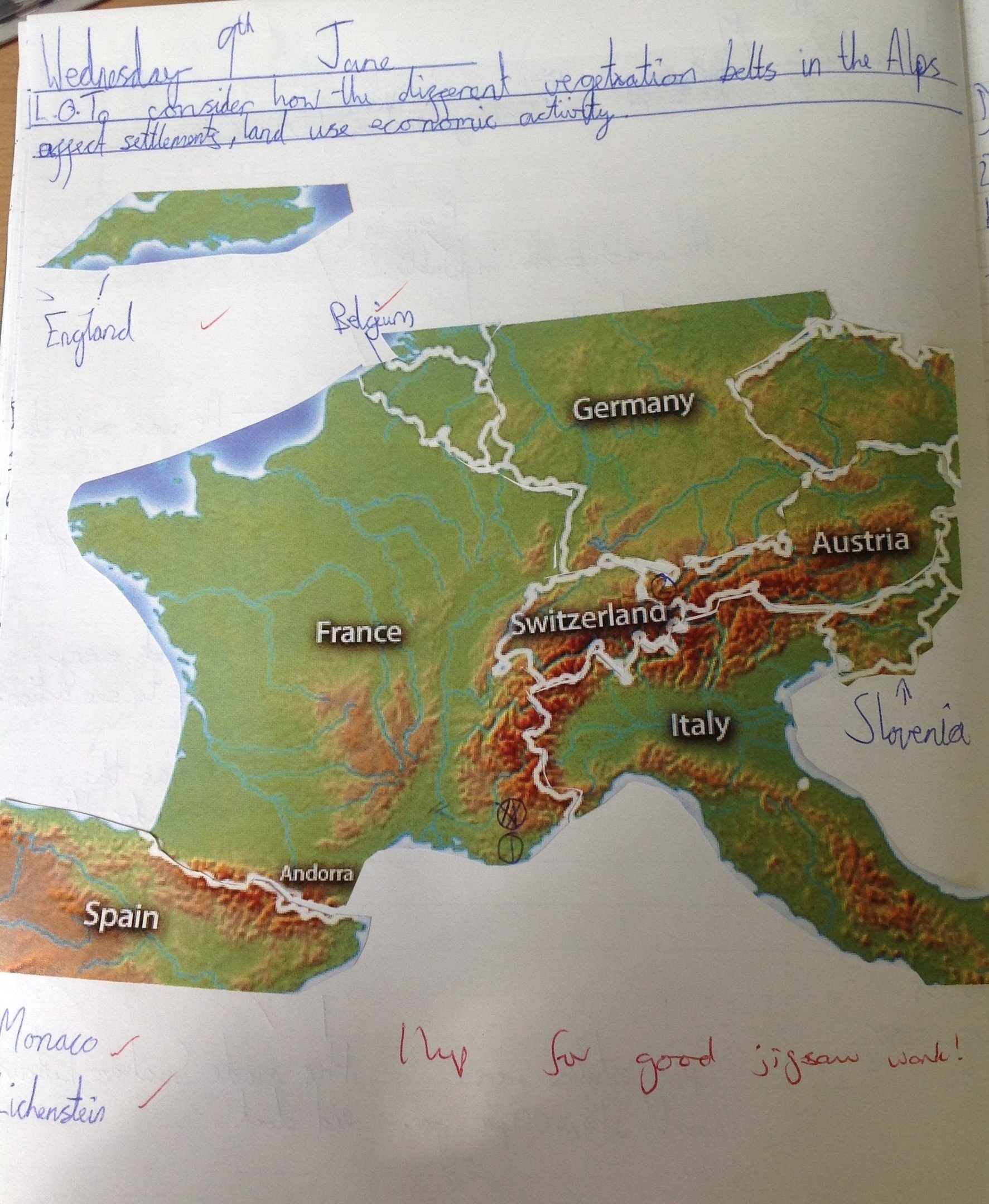
In Geography this term, Y6 have been building on their knowledge of biomes and considering vegetation belts.
We focussed upon the Alps and completed a countries jigsaw to enhance our knowledge of the countries which the Alps run through. That wasn’t as easy as it sounded!
We then explored the human and physical geography within the Alps, carefully considering tourism and the impact which that has on the area.
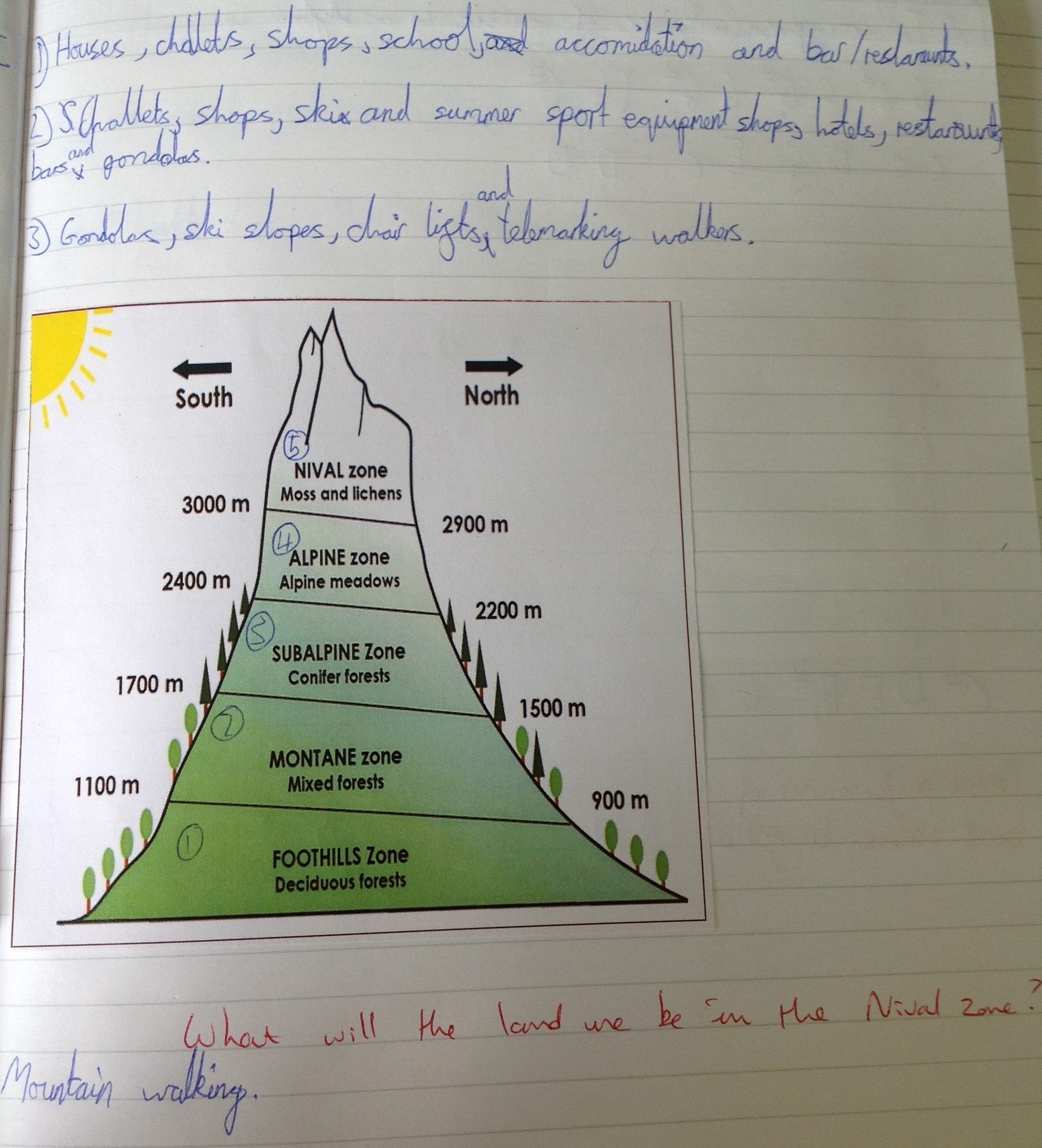
Alongside this, we considered the vegetation belts in the Alps and compared these to the Himalayas.
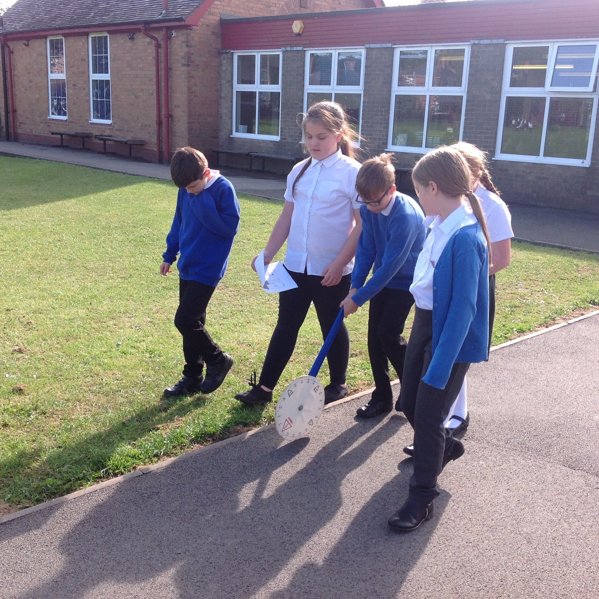
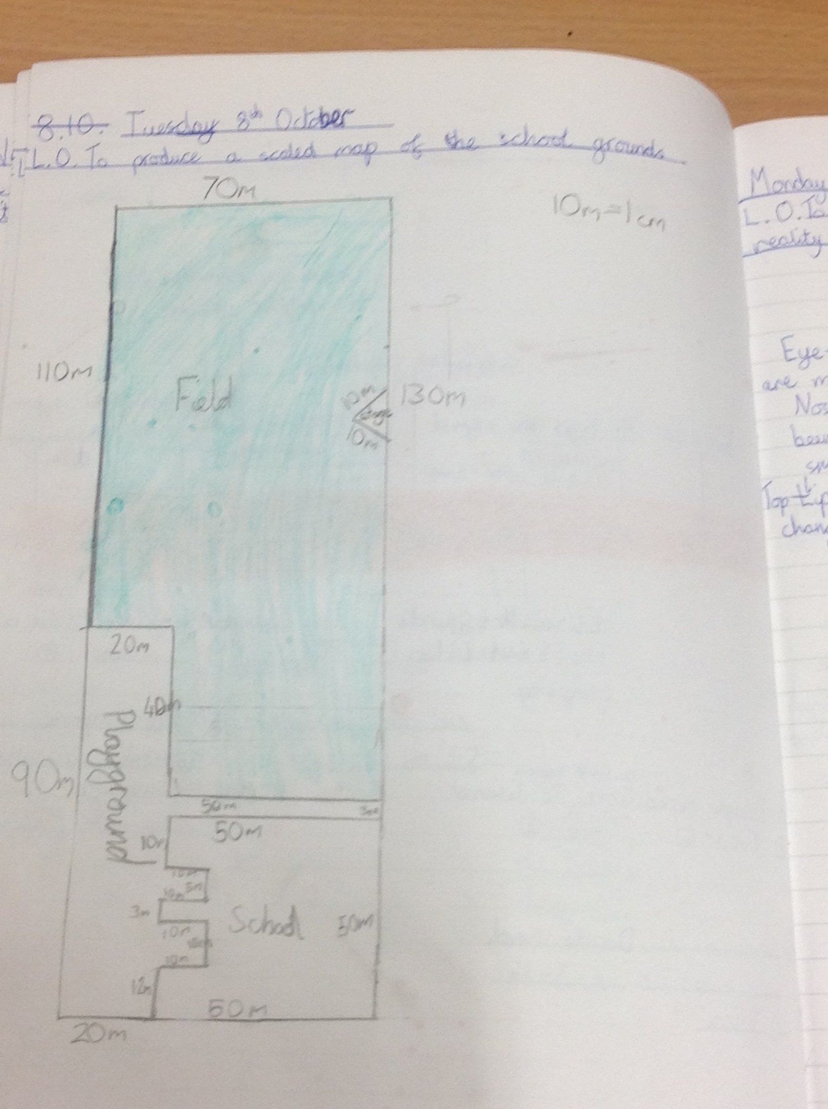
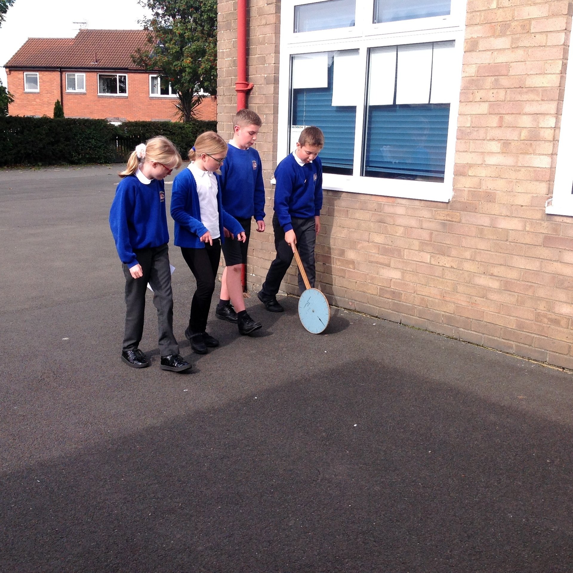
Year 6 have been investigating scaled maps and we used trundle wheels to measure the perimeter of our school grounds in order to create a scaled map of our school. We have also been finding out about 4 and 6-figure grid references and looking at Ordnance Survey maps. We used these and Google maps to plan a journey home if we had been left behind at Robinwood!
 |
 |
 |